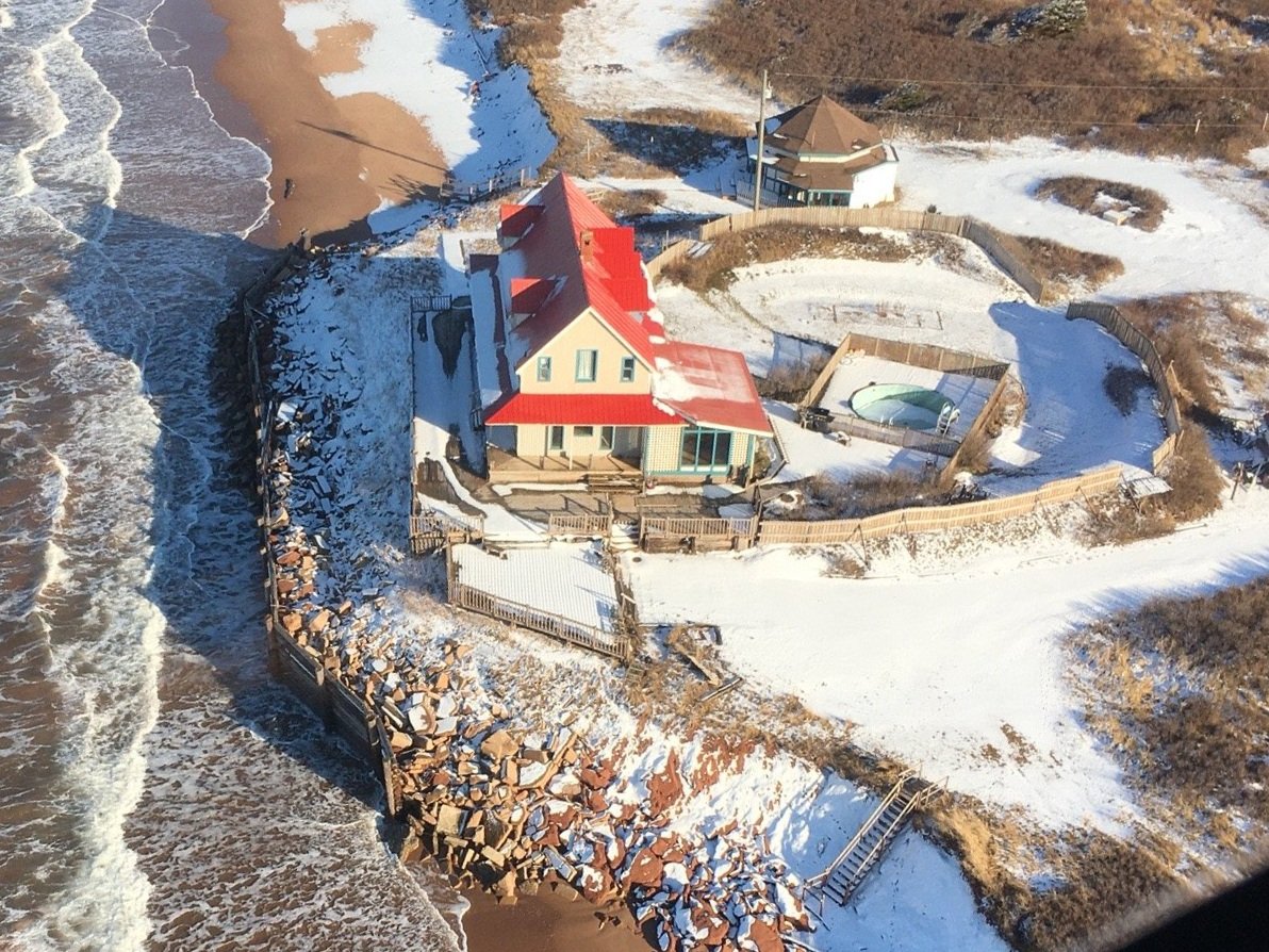
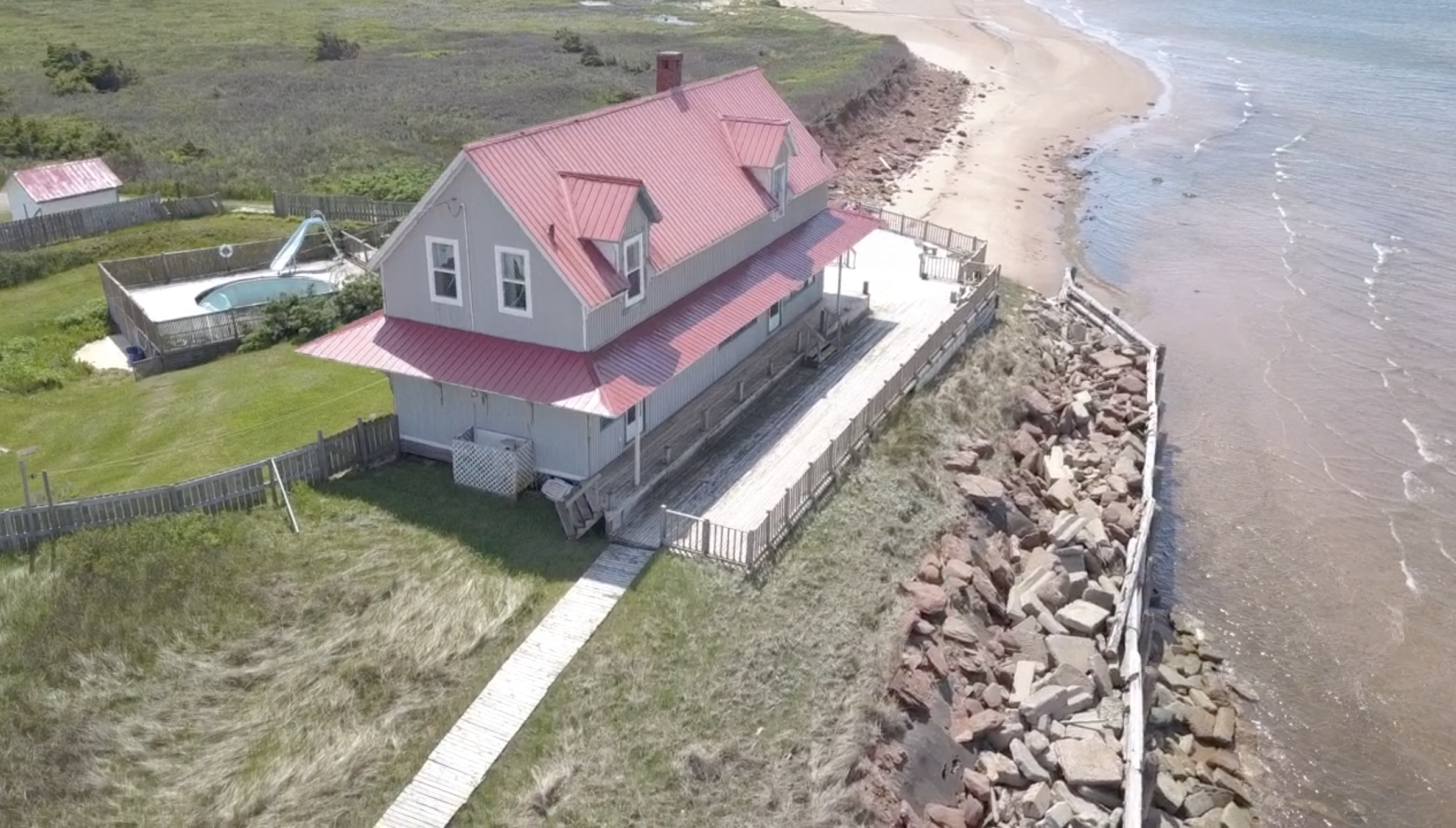
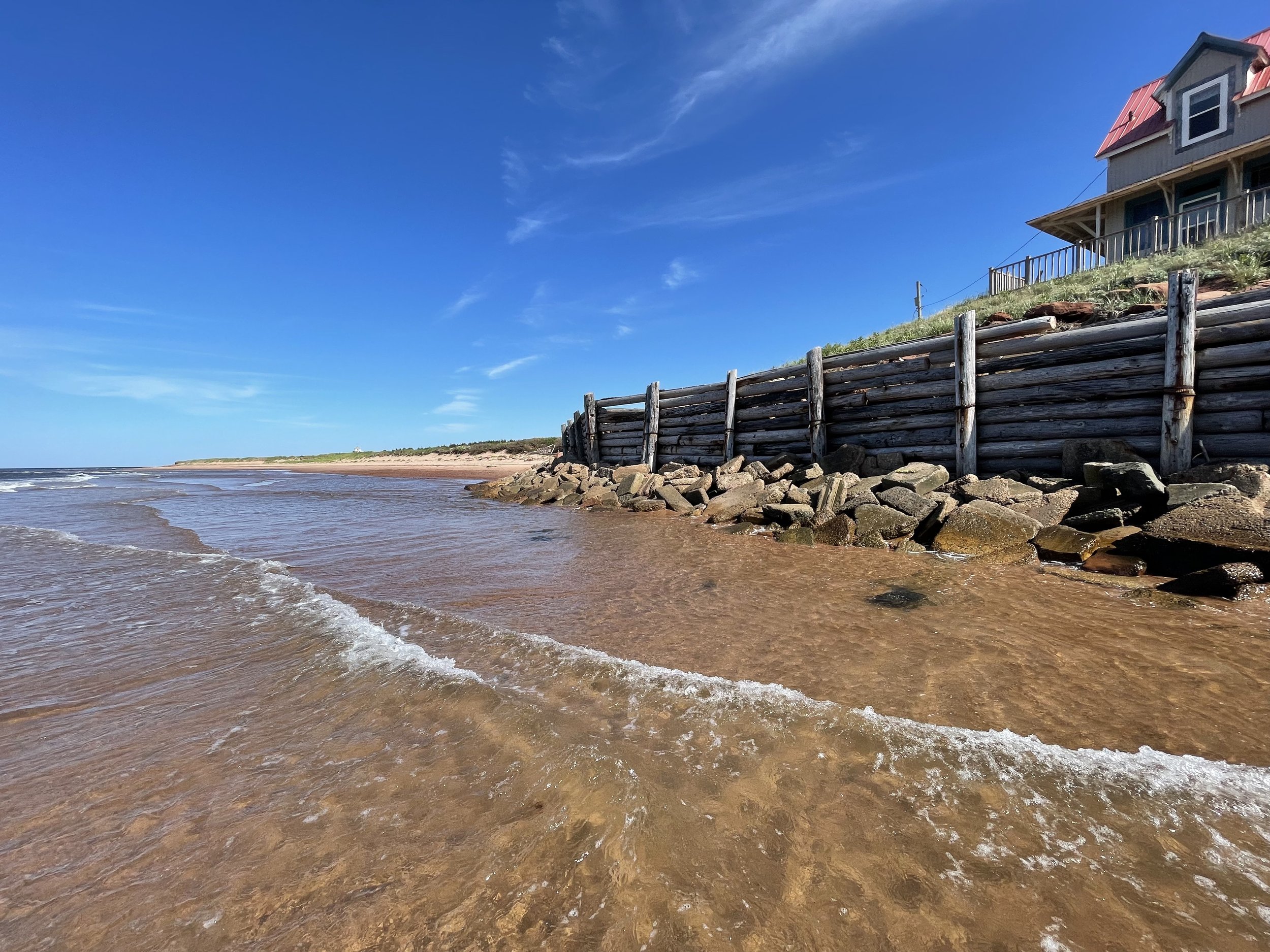
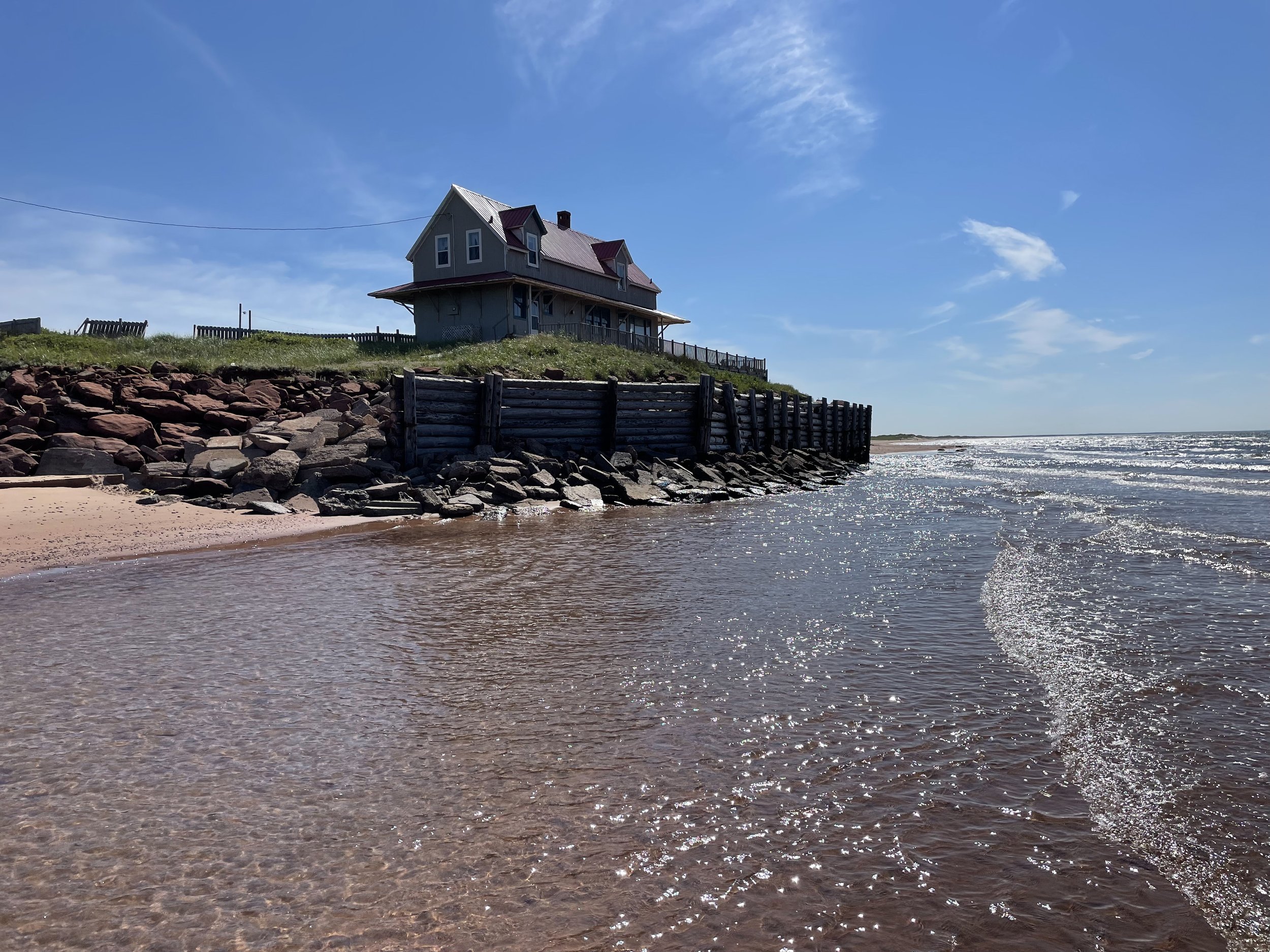
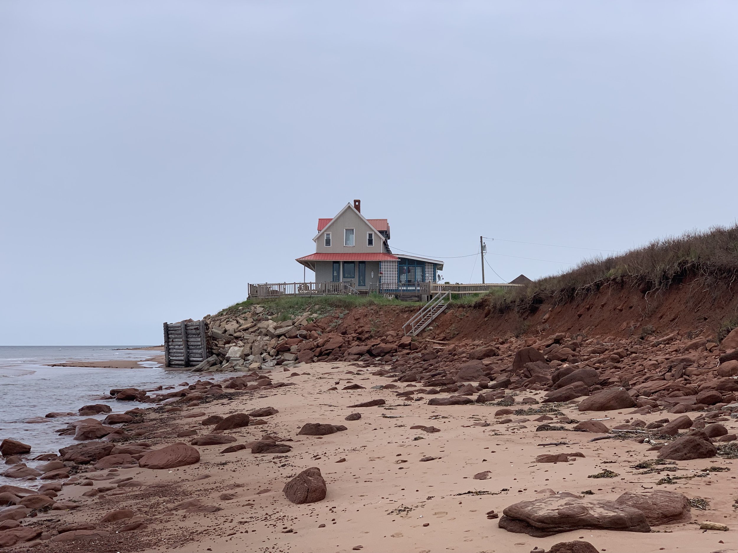
The Point Deroche Property Has Been Protected By A Seawall For Around 30 Years.
The original islander resident owner of the Point Deroche property constructed a large seawall in the 1990s. For approximately 30 years, long before the current owners purchased the property in 2020, this shoreline has had a substantial shore protection system in place.
An excerpt of a report on the old seawall, commissioned in 2019, described it as follows:
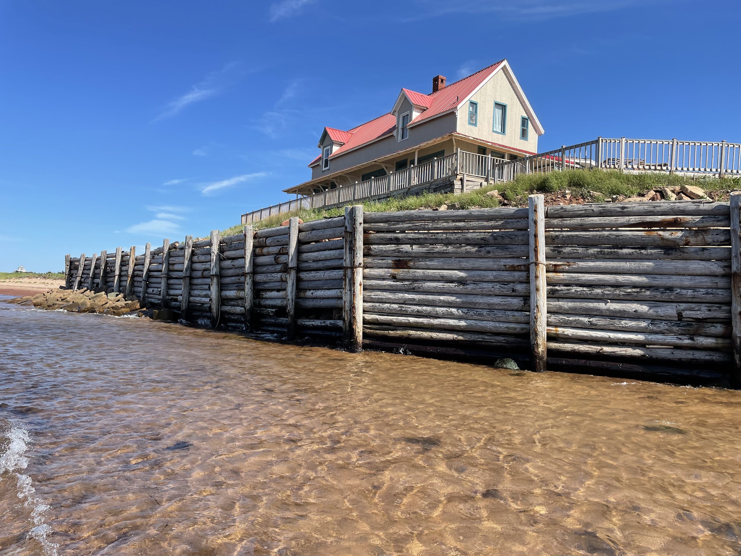
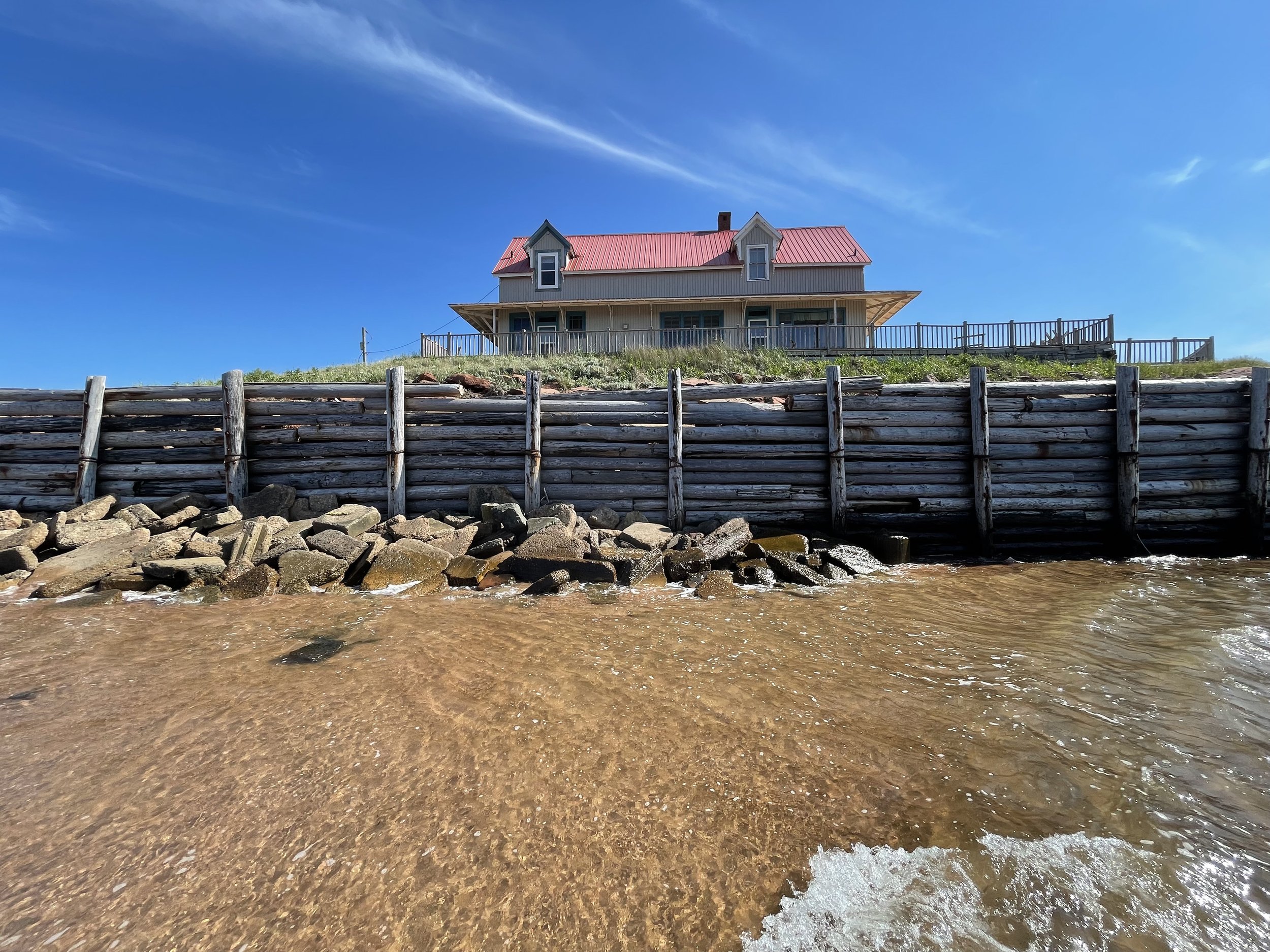
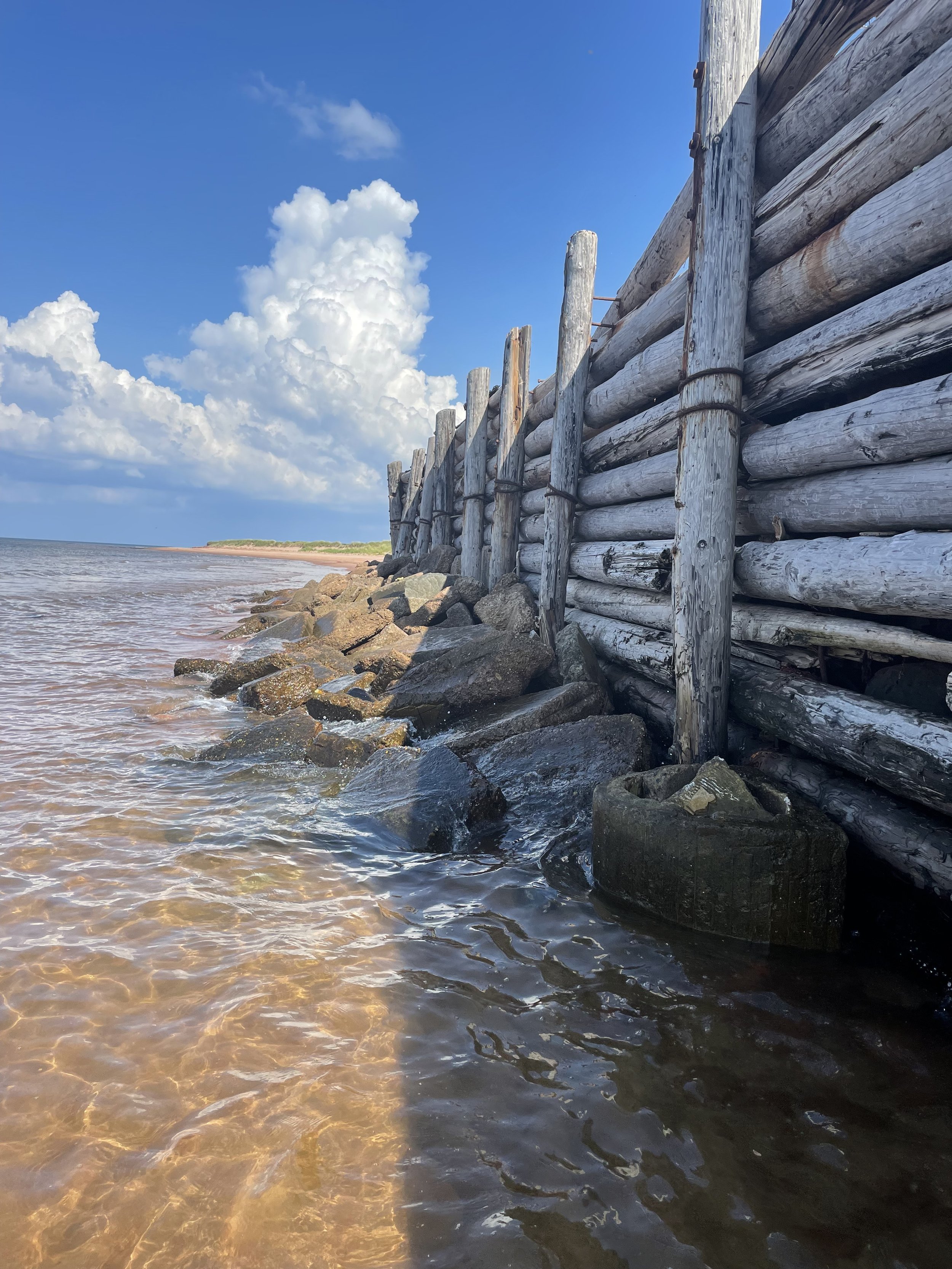
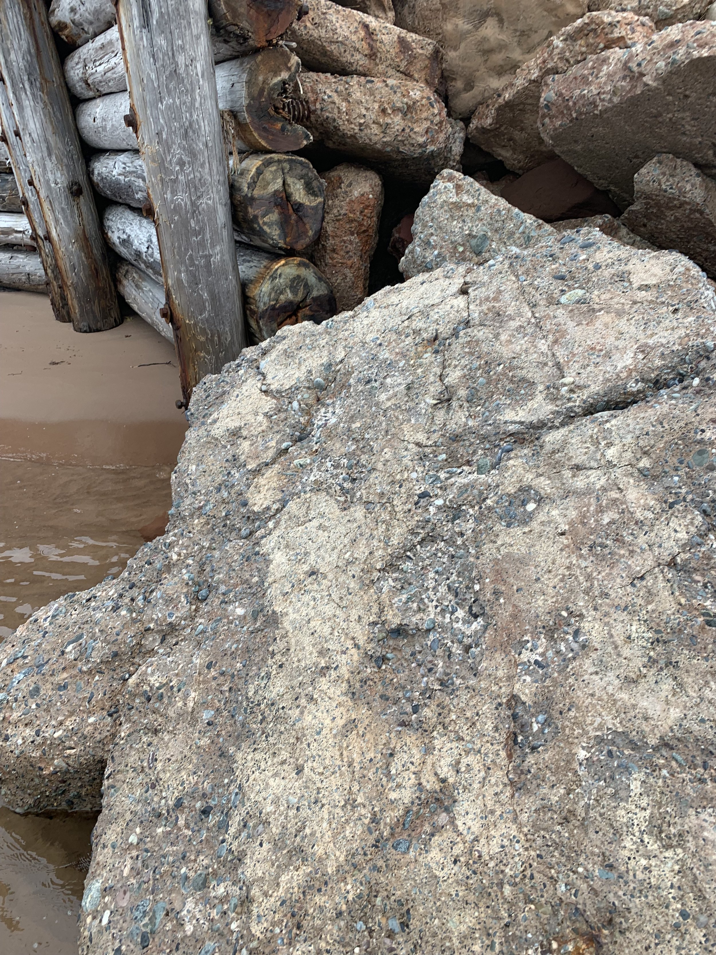
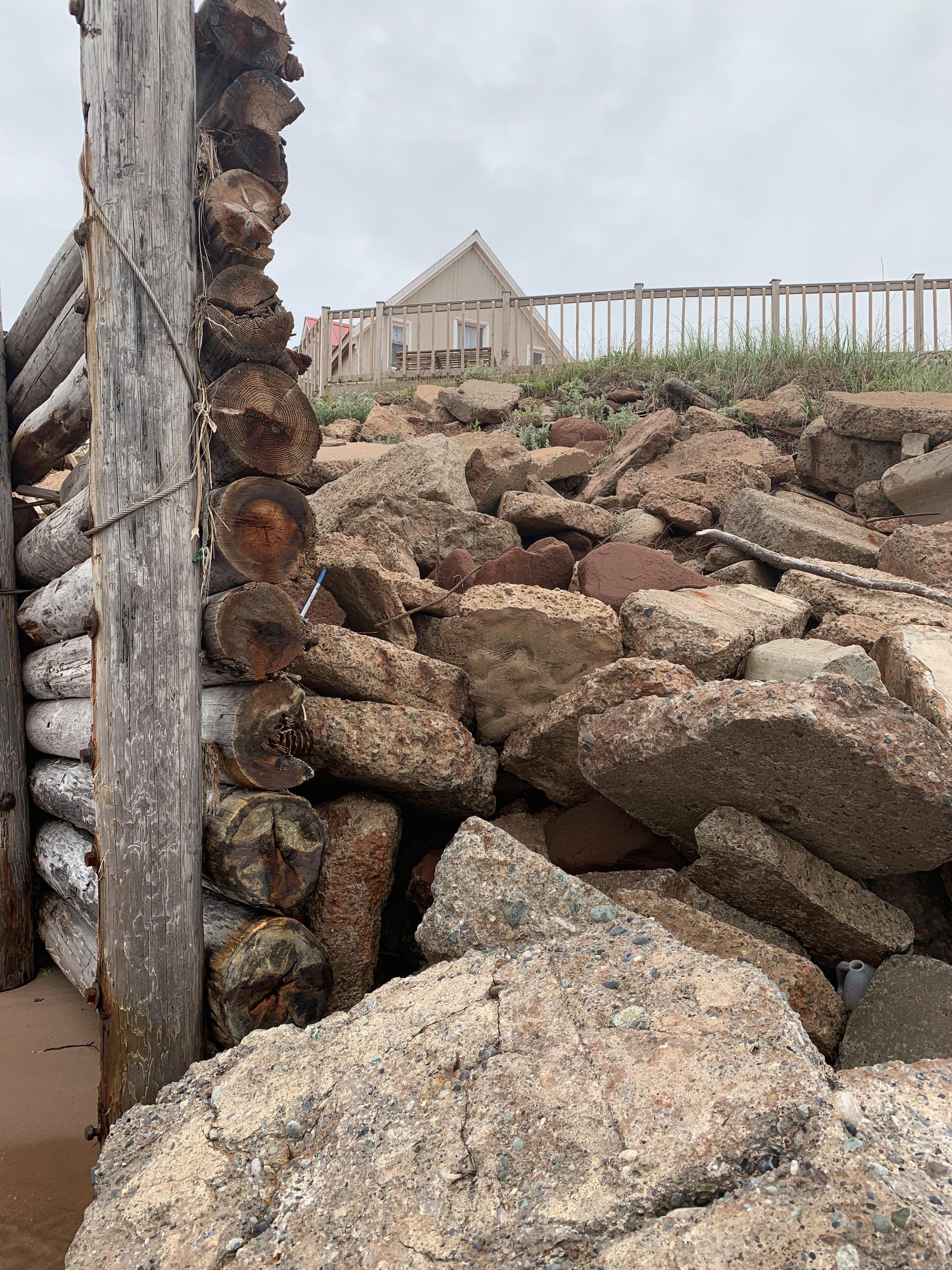
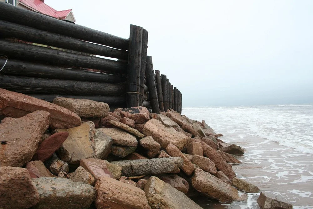
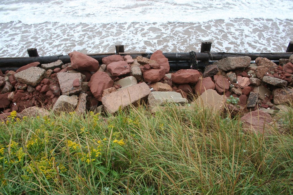
The predominant shore protection structure is a timber work bulkhead wall (approx. 70m in length and approaching 3m height) consisting of driven ‘creosote’ timber piling and horizontally-laid creosoted timber poles (perhaps piling) acting to retain the embankment fills and upper slope armour immediately surrounding the seaside deck of the residence. There was evidence of geotextile having been placed behind this wall. This was seen due to deterioration and losses of the sandstone rockfill behind the wall and its associated surface subsidence. The presence of the geotextile would suggest the wall would have been constructed in the 1980’s. The assembly has been restrained against lateral backfill loads by the use of steel cables to anchorage of unknown details. This may also be driven timber piling, given the numerous steel cable wraps seen at the seaward face, though this is speculative.
Secondary shore protection (east and west) of the primary timber structure has been achieved by placement of mixed armour materials, again salvaged concrete and local sandstone. These segments were some 16m at the west shoreline and approximately 28m at the eastern side of the property. Evidently these materials had been placed and maintained/extended to address ‘flanking’ erosion to either side of the primary timber structure.
The primary timber wall is showing signs of distress including rusting of anchorage cables and bolted fastenings, timber damage and losses in the lower wall extremities and evident low-water abrasion at a particular pile in the western portion…The western extremity appears to have the highest wave exposure, losses of sandstone armour (and associated shifting and exposure) seem more pronounced in this area.


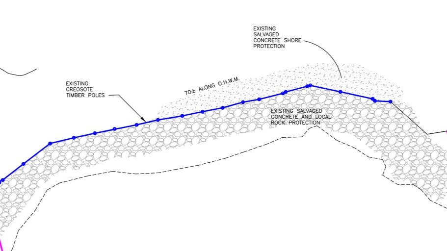
Survey of Old Seawall
The survey excerpt below shows the outline of the old vertical seawall shown in blue. Note the presence of significant piles of salvaged concrete material outside of the creosote timber wall. These piles are also visible in some of the photos in this section. The removal of these piles, as well as the setback of the new toe stone by 3 feet from the old timber wall, quite noticeably improves access around the new shore protection for the beach walking public. Access is improved by over 10 feet in the area where the piles of salvaged concrete shore protection were removed.
Erosion around the Old Seawall Featured in National Media over the past decade.
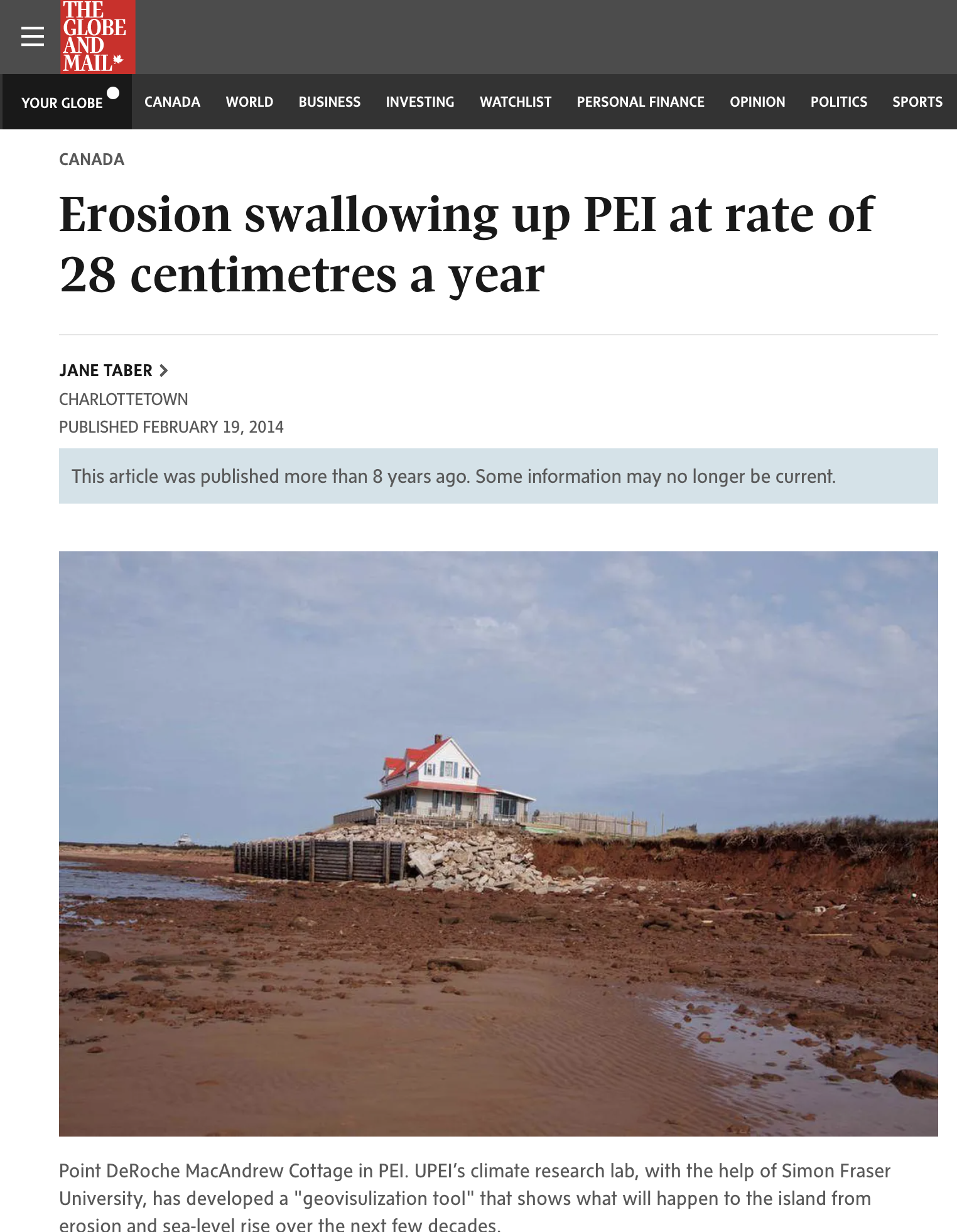

The Point Deroche site has been featured in various national media articles documenting the the rapid rate of erosion in PEI. The Old House and seawall were featured in a Globe & Mail article nearly 9 years ago. The property was featured in these national articles as it shows better than most locations the dramatic impact of erosion over the past several decades. The photo used in the articles here in particular shows the poor state of the old seawall.

The original developers of the property were Jack MacAndrew and his wife, Barbara. Jack was a long-time CBC journalist and media personality. They built the seawall decades ago to protect their summer vacation home, which featured a swimming pool, a detached guest cabin, and various outbuildings. It was on the rental market for many years before the property was sold.
The new shoreline work takes place entirely within the footprint of the original MacAndrew breakwater. The new shoreline system modestly improves beach access and significantly enhances safety and sightlines for infrequent public visitors to this remote area. It also ensures the protection of the land that was purchased from the MacAndrew family.